MAR/APR 2021, OUR 25TH YEAR
WATERY WONDERS OF CHIAPAS, MEXICO |
||
Story and photos by Vicki Hoefling Andersen |
Close your eyes and think “Mexico,” then “water” and I’ll bet a palm-studded beach with wave-kissed shoreline comes to mind. While Chiapas, Mexico’s southern-most state, has miles and miles of that very shoreline (think Mazatlán), her interior holds a variety of liquid wonderlands plopped in the middle of raw nature.
 |
 |
|||
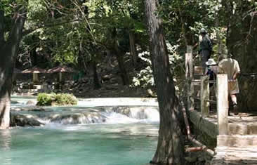
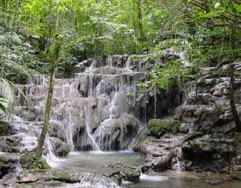
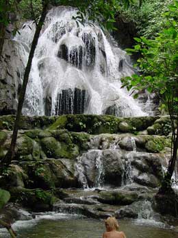
El Chiflon pathway in Chiapas |
El Chiflon swimmers in Chiapas |
About a half-hour from Comitán de Dominguez, flow the magnificent waterfalls of EL CHIFLÓN. As the San Vicente River traces its way through the bedrock of a small valley, it forms a series of five waterfalls. Entering through the Centro Ecoturístico Cadenas de Cascadas El Chiflón eco-center, a paved path (above left) hugs the river’s edge with picnic areas and rental cabanas scattered along the way. The multi-hued river froths over age-worn limestone, forming numerous pools that invite a plunge. Just be sure it’s not one of the handful that are posted against swimming.
|
 |
|||
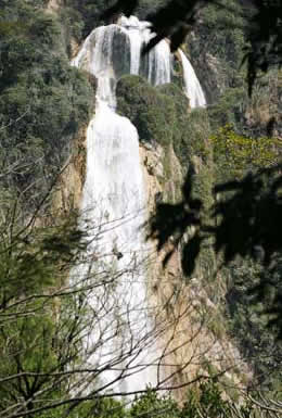
Chiapas El Chiflon waterfall Ala de Angel |
Chiapas El Chiflon waterfall Velo de Novia |
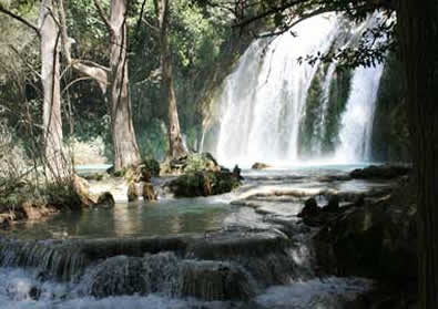
As you amble along the riverbank between valley walls thick with lush forest, you first come upon El Suspiro, then Ala de Ángel (above left), followed by Arcoíris and Quinceañera, each a beautiful cascade in its own right. You’ll have glimpses of the final prize here and there along the way. But when you think you’ve finally reached the ultimate viewing platform for Velo de Novia (above right), keep going. Look for the small unmarked dirt path that leads to the best view of this angel-wing-shaped waterfall erupting from the hillside before it tumbles 394 feet into a small pool below.
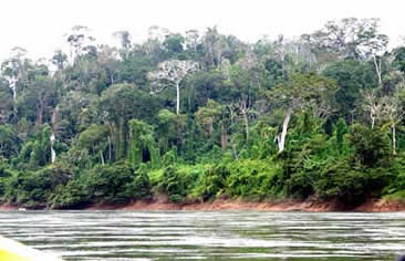
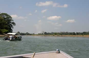
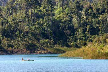
One of Mexico’s mightiest and most indispensable rivers, the RÍO USUMACINTA (below left) delineates much of the border between Guatemala and Mexico. During its 620-mile journey northward to the Gulf of Mexico, it also separates the Mexican states of Chiapas and Tabasco and provides water, food, irrigation and a transportation route for the entire river basin.
 |
 |
|||
Chiapas Rio Usumacinta riverbank |
Confluence of Rio la Pasion and Rio Salinas |
Named for the Howler monkey, it is created by the confluence (above right) of Guatemala’s Río la Pasión and Salinas (aka Chixoy or Río Negro) Rivers, and is one of the largest rivers in Mexico and Central America. During the dry season it can run up to 50,000 cubic feet per second, but in the rainy season its volume is twice that. Mostly flowing smoothly along, in places it hands out Class II, III and III+ rapids for a water sport enthusiast’s adrenaline rush.
 |
 |
 |
||||
Usumacinta Morelets crocodile |
Usumacinta spider monkey |
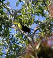
Usumacinta toucan |
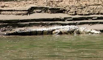
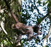
The river’s path through the jungle covers an amazing diversity of surrounding canopy and wildlife. In places the riverbank is sandy and etched with evidence of fluctuating water levels, perfect sunning spots for Morelets crocodiles. In other sections, the trees encroach on the river’s edge, with spider monkeys and toucans just a few of the critters in the branches overhead.
 |
 |
|||
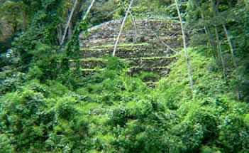
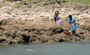
Usumacinta Yaxchilan structure |
Usumacinta wash laundry day |
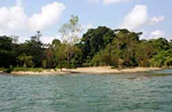
The Usumacinta and its tributaries were vital to the ancient Maya, who used it as a route between the highlands and Petén regions of Guatemala and the Gulf of Mexico. Along this route, where many of their cities were located, they traded items such as obsidian, cacao, shells, jade and other precious commodities. The Usumacinta itself separated two powerful rivals, Piedras Negras and Yaxchilán, the latter of which has a few structures just visible from the river (above left). Even today many of their descendants head to the river for their laundry and bathing needs.
RÍO USUMACINTA boat ride video |
 |
 |
|||
Rio Otulum stream |
Rio Otulum waterfall |
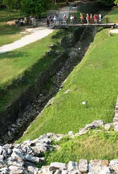
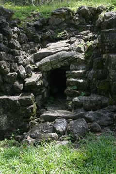
It may not be the mightiest of Chiapas’ rivers, but it is among the most mystical. A tributary of the Usumacinta, RÍO OTULÚM emanates from the rainforest-covered Tumbalá mountains of eastern Chiapas. Much of this river or its side streams (above left) pass right through the ancient Maya city of Palenque. While most Maya cities had to depend on cenotes or sinkholes for water, Palenque had the opposite problem: too much of the vital liquid. The Maya’s solution to control flooding and utilize this precious resource was to channel it into canals and aqueducts that criss-crossed the city before allowing it to resume its natural course (above right).
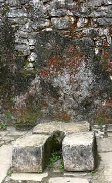
Adjacent to The Palace is one of the most visible canals (below left). This canal passes through an eight-foot high vaulted-roof aqueduct (below center) which in 2010 archeologists discovered was pressured – the first one of its kind identified from the ancient world. Water was routed through The Palace to supply toilets (below right), kitchens and steam baths.
 |
 |
 |
||||
Rio Otulum Palenque canal |
Palenque aqueduct |
Palenque palace toilet |
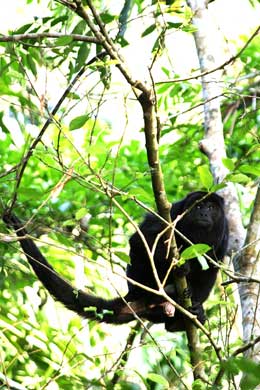
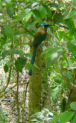
Whether you’re strolling Palenque or tracking the Río Otulúm, listen and watch for howler monkeys (below left) and motmots (below center) among other local denizens. You might even pause and dip your toes in the Queens Bath (below right).
 |
 |
 |
||||
Rio Otulum howler monkey |
Motmot |
Queens bath |
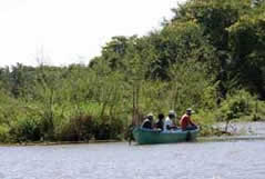
About an hour north of Palenque, the small town of Playas de Catazajá (population approx. 20,000) is a gateway to LAGUNA CATAZAJÁ, a jumbled network of waterways and islands that covers over 60 square miles and is celebrated for its great fishing, diversity of avian critters, and huge variety of aquatic species including Antillean manatees.
 |
 |
 |
||||
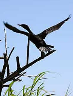
Laguna Catazaja cormorant |
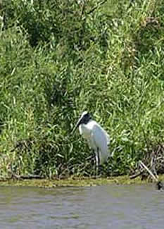
Ibis |
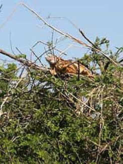
Red iguana |
A leisurely boat ride in the lagoon and around some of its small islets reveals an abundance of wildlife such as cormorants and ibis (above left and center). Red iguanas (above right) in huge numbers bask on branches or in trees.
 |
 |
 |
||||
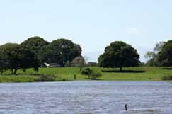
Laguna Catazaja shoreline |
Fishermen |
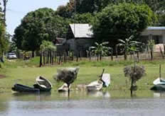
Laguna Catazaja village |
Some sections of lakeshore with their grassy, tree-dotted expanses in this serene region would be the envy of most golf links. The Lagoon is noted for its fishing, and even hosts a bass tournament every fall. Locals also bring in snook, carp, wolf fish, gar and prawns.

La Encrucijada Biosphere Reserve mangroves
Chiapas has many other magical waterworlds to explore. Along the Pacific Coast, LA ENCRUCIJADA BIOSPHERE RESERVE encompasses 560 square miles of wetlands, lagoons, sandbars and some of Mexico’s tallest mangroves (above). The diversity is so rich and unique, in 2006 it was designated a UNESCO Biosphere Reserve. The Reserve is home to 323 varieties of flora and its wildlife population boasts a myriad of different species: 34 species of reptiles, 11 of amphibians, 294 of birds and 73 of mammals. Birders in particular flock here (excuse the pun) year-round to view nesting and migratory feathered critters. The Reserve’s jaguar population is one of the largest in the country.
Lagunas de Montebello Laguna Bosque Azul
The setting for LAGUNAS DE MONTEBELLO, or Montebello Lakes National Park, is reminiscent of the temperate pine forests and lakes of the Pacific Northwest. Just north of the Guatemalan border, Mexico’s first national park (established 1959) includes 59 lakes of various size with colors ranging from emerald to turquoise to purple thanks to their various mineral contents and lighting. Laguna Bosque Azul (“Blue Forest Lake”, above) is one of the largest, yet few folks other than locals come to boat, fish or swim among the tranquil surroundings.
 |
 |
 |
||
Rio Lacantun |
Scarlet macaw |
Las Guacamayas explorers |
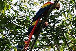
Flowing through the middle of the Montes Azules Biosphere Reserve, RÍO LACANTÚN (above left) is another tributary of the Usumacinta. Created in 1978, Mexico’s first Biosphere Reserve is hailed as the most biologically diverse region in North America with 114 mammal species, 341 birds, 112 fish, 23 amphibians and 54 reptiles. Nearly 3,400 varieties of plants and 1,500 different trees, have been identified including 70 orchid species once found in a single tree. The Maya have occupied much of the region since 200 CE which is still home to the Lacandón Indians, thought to be one of the most direct descendants of those ancient people. In 1991 they established the Las Guacamayas Centro Ecoturístico for the conservation of the “guacamaya” or Scarlet Macaw (above center). Situated on the Río Lacantún, it’s the perfect jump-off point for guided hikes or boat rides through the Reserve.
| Vicki Andersen has been writing about skiing, snowmobiling, motorcycling and adventure travel for decades. Over 300 stories appearing in more than five dozen local, regional and national outlets bear her byline. Since joining the HighOnAdventure team in 2005, her stories have ranged from Iceland to Alaska, Hawaii to Fiji, across Mexico and Central America, and other intriguing locations. Check out more of her stories at https://www.highonadventure.com/Library/StoriesVicki.htm or contact her at skicat1@comcast.net. |  |