Lost—and found.
When engineers were building a highway along California's coast, the outlook for extending the road along one far northern California section was simply too daunting. The challenges included the King Range mountains that rise steeply along the coast coupled with the area's proximity to the San Andreas Fault. Instead, the highway was relocated inland. The section it skirts has become known as the Lost Coast.
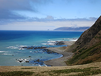
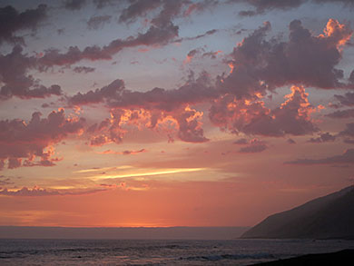
Looking north on the Lost Coast
Decades later, finding ways to travel this Lost Coast remains challenging.
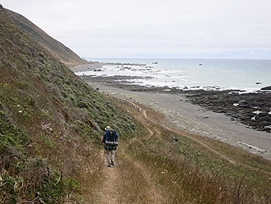
There are no easy, quick roads to its north and south access points, nor to Shelter Cove, the coastal community that divides the 52 miles of trail. While the southern 27-plus miles ambles up and over cliffs and is known as the "ridge walk," the northern 25 miles, known as the "beach walk," mostly follows a narrow shoreline with sections impassible at high tides. That's the one we took.
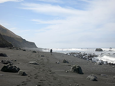
View from Windy Point
It took planning - and a friendly shuttle driver - to get there, but by late morning our group of four unloaded at the Windy Point Road, not the traditional Mattole River trailhead, for our intentionally leisurely four-day backpack.
Hiking along the beach
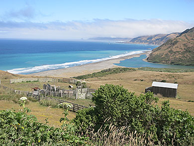
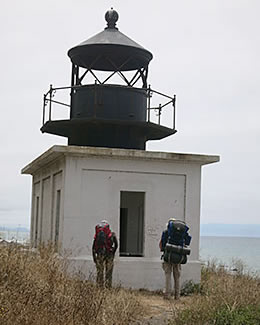
The rewards came quickly, beginning with panoramic views of the coast north to Cape Mendocino and south past Punta Gorda - Spanish for “massive point.” Easily found was the decrepit Punto Gorda Lighthouse. We explored the abandoned structure, known as one of the Pacific Coast's loneliest outposts. Built in early 1900s, the lighthouse closed in 1951 because of high maintenance costs.
| |
 |
|
 |
|
| |
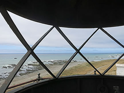
View from the lighthouse |
|
Loneliest lighthouse |
|
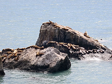
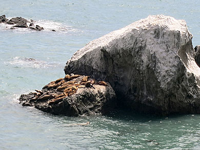
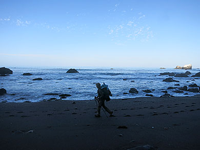
Nearby on an exposed beach we saw about a dozen seemingly lifeless creatures. It was pure relief when one, then another, of the Stellar sea lions lightly flicked their flippers. Our route alternated between a black sand beach cluttered with rocks - some the size of golf balls, others slick roly-poly boulders - and sandy beaches. As predicted by our maps, our route traced "the wildest beach in California."
And wild it was. The ocean views included rocky islands cluttered with slumbering sea lions. At the appropriately named Sea Lion Gulch the primary campsites were filled by earlier arrivals. Instead of bivouacking there, we retreated to an open area perched above a bubbly creek. We were greeted by a sea lion symphony, the barking deep-throated guttural “grrrrrlll” growls of gargantuan elephant seals exerting their dominance.
| |
 |
|
 |
|
| |
Sunbathing sea lions |
|
Rocking out |
|
On one rock island a monster-sized male struck poses, sometimes menacing, other times as though they were rehearsing samurai moves. On an adjacent island, another giant periodically growled and rocked his body, especially when a second male tried to wriggle to his high spot. At times large waves swept the lower exposed rocks, sending groups of smaller sea lions cascading into the water.
Variations of red sunset
An evening walk featured a brilliant sunset brilliant with kaleidoscope changing variations of red, burgundy and crimson. Even more amazing were cormorants hanging precariously from mud nests somehow slapped against steep walls.
Into the night the sea lion lullaby continued - some croaking like frogs with sore throats.
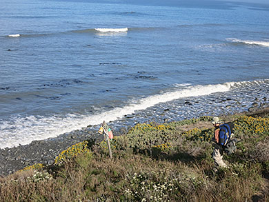
The next morning we continued south. The tide had gone out far enough to expose a narrow strip of sand along the otherwise impassible section, so we stepped quite carefully to avoid waist-high poison oak along sections where the trail hugged the cliffs. Sometimes we hiked along the beach, which was variously spongy-sandy soft or littered with rolling rocks. Occasionally the route veered up and over gentle highlands.
| |
 |
|
 |
|
| |
Hiking the beach |
|
Down the cliff |
|
During a break along Spanish Flat, two people we had passed earlier strolled past us. Then the man carrying a gigantic pack stopped, retreated and handed us a packed of pistachio nuts. Later in the day, on another leap frog, he again passed us, after providing heaping handfuls of chocolate-covered raisins.
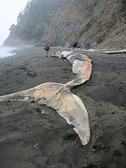
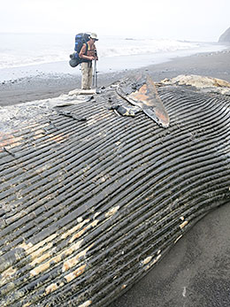
What first appeared to be a massive beached tree was a wild illusion. Upon closer inspection, we found it to be an 85-foot long dead blue whale. Sad but curious, we circled it, admiring its behemoth size, fringed plates of baleen, triangular flukes, tapered body and its plated underbelly.
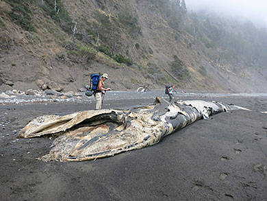
Dead blue whale
| |
 |
|
 |
|
| |
Behemoth whale |
|
Examining the flukes |
|
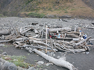
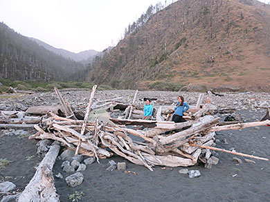
That night we camped at Big Flat Creek, enjoying unusual beach weather – sunny skies with toasty temperatures into the 80s. We pitched one tent inside a large jury-rigged wooden framed shelter built for wilder weather, and another near the campfire pit. Over dinner we chattered about visual treats, critters like sea urchins, huge chitin snails - that look like mangoes sliced in half - and limpets, aquatic snails with shells evolved to mimic the shape of the rocks they hug.
Wind protected wood-framed shelter
During our hike we sighted river otters, cottontails and jackrabbits, deer, snakes and, according to our retired National Park Service naturalist, a trio of elephant seals at Rattlesnake Creek. Surprisingly and suddenly, one “elephant seal” popped up onto a surfboard, followed by his surfing friends.
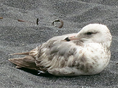
Friendly gull
Our third day along the beach we again timed our walk to take advantage of low tides along a long stretch impassible at high tides. While eating dinner at Horse Mountain Creek, a friendly gull waddled up, curiously watching us and hoping for handouts. Tossing a treat was tempting - but if we did - another 100-plus gulls lined in a neat row were ready to stage a massive Alfred Hitchcock "Birds" invasion.
Evening light
The final stroll was a leisurely celebratory stroll along Black Sands Beach to Shelter Cove. We talked about our "gifts from the sea," including a brilliantly shiny abalone shell I'd pried from some rocks, and a tarnished coin that I first imagined had traveled across the sea. Instead, I discovered that it was a quarter with an image of Crater Lake.
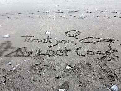
Thanks
Our collective feelings were expressed in the message carved in the sand by the youngest of our group - “Thank You, Lost Coast!”
When You Go
Roads leading to the Lost Coast are steep, narrow and winding. Driving distances are deceptive because driving fast is impossible. To reach the north access at Mattole River - from Highway 101 take the Ferndale exit and, from town, follow signs to Petrolia. A mile beyond Petrolia turn right on Lighthouse Road and drive 5 miles to the Mattole Recreation Site. Allow about an hour and 15 minutes for the 42-mile trip.
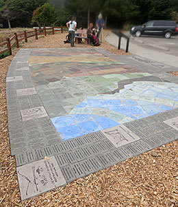
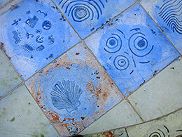
Creative tiles at the Shelter Cove trailhead
Information is available at the King Range National Conservation Area, P.O. Box 189, 768 Shelter Cove Road, Whitethorn, CA 95589, 707-986-5400, and the Bureau of Land Management, Arcata Field Office, 1695 Heindon Road, Arcata, CA 95521-4573, 707-825-2300. For details, obtain the BLM's King Range National Conservation Area Recreation Guide or Google "Lost Coast Trail."
Also helpful is the Wilderness Press's waterproof California's Lost Coast Recreation Map www.wildernesspress.com or 800-443-7227.
"Backpacker: Trekking California," by Paul Richins Jr., features a chapter on the Lost Coast Trail with information and maps.
Lee Juillerat is a semi-retired reporter-photographer in Southern Oregon and frequent contributor to regional magazines and publications. Recent stories have appeared in Southern Oregon magazine, Alaska Airlines' in-flight magazine, Northwest Travel and others. He has written and co-authored books and brochures about a variety of topics and published photo-stories in High On Adventure for nearly 20 years. He can be contacted at 337lee337@charter.net
|