Let's begin near the end, on top of Mount Whitney.
I'd taken the long way, and a long time, to stand atop the 14,505-foot peak, the highest in the continental U.S. Although I've summited Mount Shasta nearly 40 times, stood on top of Mount Rainier five times, and scaled most of the Cascades significant peaks, I'd never attempted Whitney.
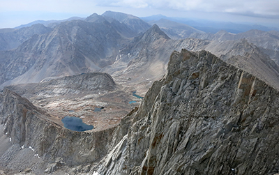 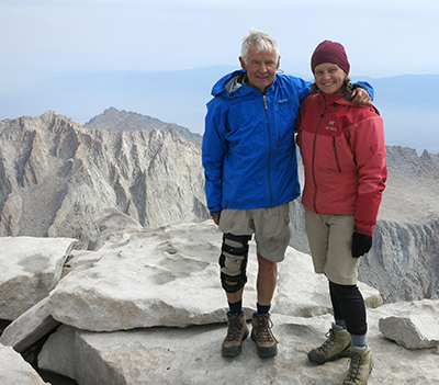 The view from atop Mount Whitney Lee and Molly Juillerat celebrate summiting Whitney The view from atop Mount Whitney Lee and Molly Juillerat celebrate summiting Whitney
Most Whitney climbers begin at Whitney Portal near the community of Lone Pine and make the vertigo- inducing 20-mile round-trip in a very long day or more reasonable two or three days. I'd started my Whitney journey 23 days earlier and 211 hiking miles away from the northern terminus of the John Muir Trail at the Happy Isles Trailhead in Yosemite National Park. Whitney was the high point, but not necessarily the highlight, of my backpacking trip on the John Muir Trail. With the hike from Whitney to Lone Pine and detours, I figure the distance was 230-plus miles.
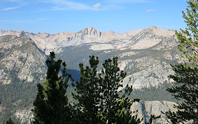
The delights, and challenges, of the Muir Trail start immediately, beginning with the Mist Trail, part of the nearly 6,000-foot elevation gain between the Yosemite Valley and Tuolumne Meadows. The visual eye candy never stops, from flower-filled meadows to a series of breathtaking, in more ways than one, mountain passes that require near daily treks up – and down – 11,000-foot passes, to the sights and sounds of bubbling streams, thundering waterfalls and dreamy lakes so welcome and beautiful it was hard to believe they weren't mirages.
Depending on the source, hiking the JMT involves cumulative elevation gains of 48,000 to 50,000 feet, with a third of the trail at elevations above 10,000 feet and six passes above 11,000 feet. What spurred the trip? Nothing in particular, but a little bit of everything: Coffee table books with alluring photos; a Backpacker magazine story touting the JMT “America's most beautiful trail. Period.” Gee-whiz tales from others who'd made the journey. A natural curiosity to see and experience the trail. And the reality that at age 68 and facing knee replacement surgery – a custom designed knee brace made the hiking possible – it was time to try.
As John Muir said, “The mountains are calling and I must go.” It's country Muir traveled, although construction of trail didn't begin until 1915, a year after he died. It wasn't until I'd finished the trek that I realized I was following Muir's footsteps.
This is how it began: One step, then a second. Repeat, repeat, repeat ...
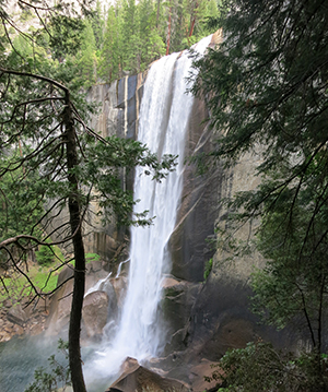 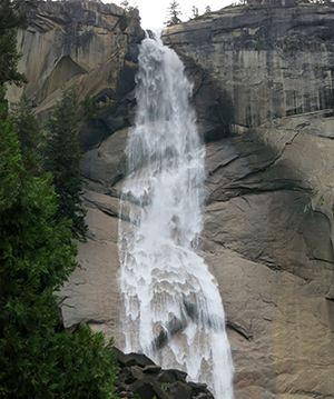
Vernal Falls and Nevada Falls are not to be missed on the Mist Trail
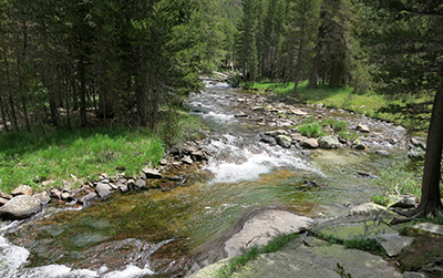
It began from a backpackers camp in Yosemite Valley about a mile from Happy Isles, the trailhead that marks the official start of the 211-mile John Muir Trail. There's no gentle acclimatization. The trail goes up, and Up, and UP. Zigzagging switchbacks alongside the rumbling-tumbling Merced River. Up more than 600 often awkwardly tall, roughhewn granite steps. Up past 317-foot tall Vernal Falls and 594-foot Nevada Falls. On previous Mist Trail hikes I'd been soaked by the spray but not this hot, sweaty day. I missed the mist.
The first six days I was joined by Joan Holliday. We covered 60 miles to Red's Meadows, where she took a shuttle to Mammoth Lakes and a bus back to Yosemite Valley.
Our first night's camp was along bubbling Sunrise Creek, nearly nine miles from Happy Isles. Along the way we'd savored views of iconic Half Dome and appreciated wondrous stands of shaggy barked incense cedar, bright red tubular shaped California fuchsias, creamy white grass of Parnassus and shaggy mane mushrooms.
I admire hikers who run the JMT in days or set speed records along the Pacific Crest Trail, but galloping wasn't my goal. I wanted time to soak my feet and swim in mountain lakes, enjoy the flowers and experience an intimacy with all that enveloped me – the air, the crescendo of dazzling sunsets, birds, sights from mountain passes, even my own breathing.
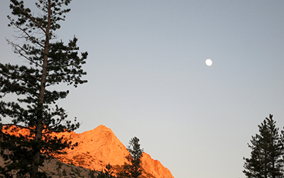  Full moon rising Lower Cathedral Lake Full moon rising Lower Cathedral Lake
Day Two, climbing again, past the High Sierra Camp, dodging mule teams and finally reaching Lower Cathedral Lake, a place to swim and camp. I thrived. But Joan, suffering from altitude sickness, was tent- bound. The next day we arrived at the Tuolumne Meadows backpacker camp. Instead of stumping on, we took it easy, spending the afternoon exploring the meadows and Parson's Lodge.
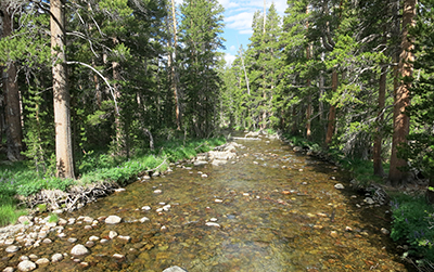  Tuolumne River bubbles through Lyell Canyon Tuolumne River bubbles through Lyell Canyon
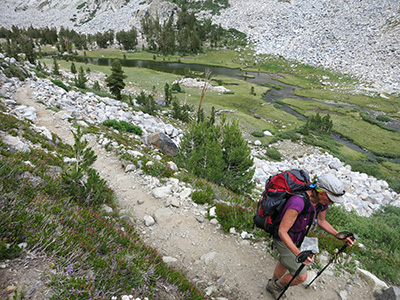
Joan Holliday up steep trail
Day Four was easy and beautiful. Joan had amazingly overcome her nausea. We strolled along Lyell Canyon and the Tuolumne River, which sometimes slides over polished granite or gurgles through narrow passages. There were harbingers of challenges to come: a series of steep elevation gains necessitating ballet-like toe dances across rocks at creek crossings. Camp was a sun-bathed tarn beneath Donahue Pass.
  Tarn below Donahue Pass Along the trail Tarn below Donahue Pass Along the trail
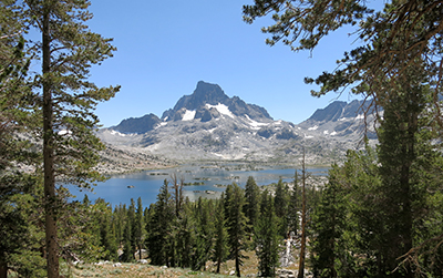
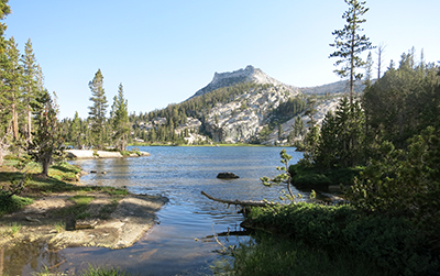
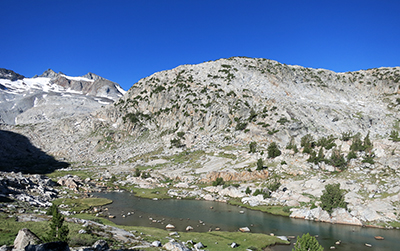
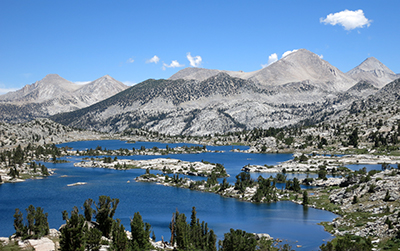
Thousand Island Lake
A new day with the first 11,000-plus foot pass, where the rewards included dazzling views of Lyell Canyon and Yosemite Valley. Add the sounds of birds – peeps, cheeps and cheap trills – and sightings of busy, business-like pikas and curious marmots. Up and down Donahue Pass, then sidling along Rush Creek with crossings, some on bridges, strategically fallen trees or hop-scotching over carefully placed river rocks. Lunch at serene Island Lake, with an exhilarating swim for dessert. Views of Thousand Island Lake. With its multitude of islets set against a backdrop of Banner Peak, it's possibly the most enchanting lake I've ever seen.
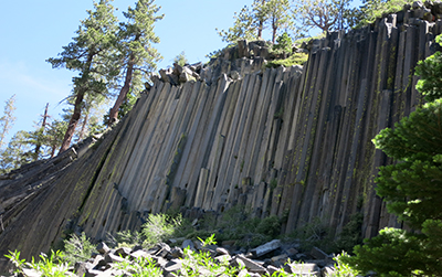 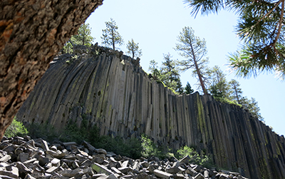
Basalt stands like 2-by 4s at Devil's Postpile
A final day with Joan to Red's Meadows, with a detour to Devil's Postpile, a series of uniformly hexagonal stands of columnar basalt, like 2- by 4's lined side-by-side. A schlep along a hot, dusty uphill trail to Red's Meadows, where the reward was a platter overflowing with a humongous burger and fries. I devoured the tummy-pleasing meal, but I was even more nourished by six days of delicious scenery. As Muir wrote, “Everybody needs beauty as well as bread, places to play in and pray in, where nature may heal and give strength to body and soul.” I was hungry for food, and for what came next.
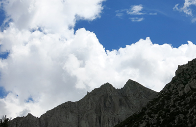
Cannonades of rolling thunder. Shards of rain and – Ouch! - pelting hail. Endless inky black skies, with cumulus clouds massing like gargantuan sky-flying battleships. Howling, tree-bending winds. Lightning strikes that – Zappppp! – glowed like flash bulbs, eerily illuminating my tent and, split-seconds later, rattled the ground. More and more endlessly longggggg echoing, roaring cascades of thunder.
Frightening? You bet.
It was only 9 in the morning when I scribbled the stormy play-byplay in my tent. During the night I'd poked my head outside and seen starry skies. Three hours earlier, during my morning pit stop, the skies were blue. I'd scheduled one down day on my John Muir Trail hike, and this was it. Luck helps.
Luck and other factors. I believe my daughter Susie, who died of cancer in 1996 and keeps a watchful eye over me during my outings, helped a day earlier. From my campsite near the Muir Trail Ranch I was crossing the swift-flowing San Joaquin River planning to soak in Blayney Hot Springs. Never happened. One of my Crocs stubbed an underwater something, causing me to tumble into the river. I watched as the Croc, which served as a camp shoe and footwear for watery river crossings, bobbled downstream. By the time I hobbled back to camp, yanked on my boots and scanned the shore, it was off on its own adventure. Damn. Now what?
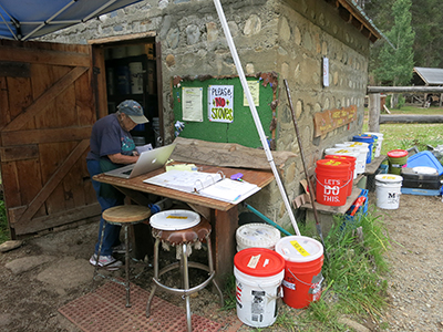
Retrieving pre-mailed buckets at the Muir Ranch
The nearby Muir Ranch, where JMT hikers mail 5-gallon buckets filled with food and gear for the final 100 miles of the trail, offers buckets overflowing with supplies previous hikers decided they could do without: commercially prepared food, home-packed food, oatmeal, Asian delights, books, snacks, clothes – more than 20 buckets worth. The contents are free for the picking. Earlier that day I'd plucked some extra dinners, bags of mixed nuts and high-energy bars. After my river fiasco, I hustled from my campsite, opened the gear bucket and there, right on top, was a pair of just-my-size water shoes. Whew.
It was a lousy day for hiking, but good for reading. I finished a paperback book I'd included in my Red's Meadow resupply box, then launched into another I'd packed in my Muir Ranch bucket. By day's end I'd finished both and deposited them in the book bucket.
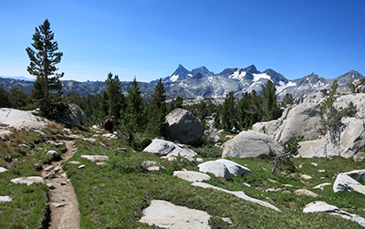
  The Minarets and high Sierras tower in distance The Minarets and high Sierras tower in distance
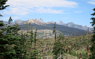
Reaching the Muir Ranch, a seven-day backpack from Red's Meadows, had been eventful. At Red's I met up with Steve Underwood, a longtime hiking-climbing friend. We hiked past 8,000 acres of fallen trees, double-whammy victims of a 1992 forest fire and more recent wind storm that had sustained blows upwards of an estimated 200 mph. The fallen trees opened up views of the Minarets, a sub-range of towering spires named because of their supposed resemblance to the minarets of Islamic mosques.
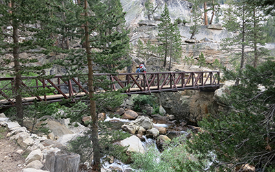  Bridge over troubled waters Gathering clouds Bridge over troubled waters Gathering clouds
Squaw Lake
We wig-wagged up Duck Pass, where we were rewarded with views of the deepening canyon ahead. We rock-hopped across creeks feeding Lake Virginia, heard sounds of drumming grouse, walked alongside rippling rivers and, more foreboding, heard echoes of distant thunder on our way to camps at Duck Pass Trail and, a day later, Squaw Lake.
At Squaw Lake, Steve doubled back, heading home. I continued south, meandering up Silver Pass past sparkling Chief and Papoose lakes, then steeply zigzagged down to a junction where the Lake Edison Trail leaves the JMT for the Vermillion Valley Resort. Three resting backpackers assured me the Vermillion ferry, despite the lake's record low levels, was operating.
  Looking back at Papoose Lake and south into valley Looking back at Papoose Lake and south into valley
I never found the ferry landing. Instead, grumbling mightily, I hiked miles along the parched lake bed before bushwhacking into the hills searching for the trail. Hearing lightning explosions and seeing rain-soaked skies behind me, I scooted along the shore and crossed steams seeking refuge. At the lake's far end was an empty boat dock and campground. Then, just when I wished it, a pickup truck searching for the resort appeared. I waved, they stopped. I tossed my backpack in the back and jumped in.
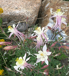 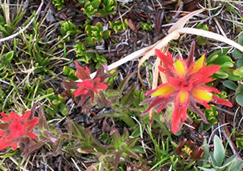 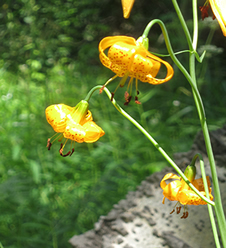
Floral displays help brighten the trail
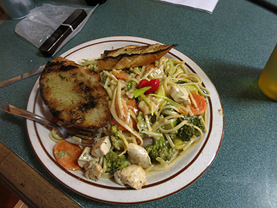
After a warm shower, a platter of thyme chicken pasta with a superb sauce and liberal helpings of broccoli, carrots, zucchini and more – a serving big enough for three – and a chilled beer proved the perfect balm to a tired body. I substituted the frustration for memories of prolific wildflowers – tiger lilies, mountain pride penstemon, arnica, multiple varieties of paintbrush, Mariposa lilies and lupine.
From Vermillion it was up and over Selden Pass, twice taking off my boots, socks and knee brace and putting on the recently found Crocs, to wade across swollen streams. The trail was viscerally delightful, flanking roaring falls and still-water ponds. Black-eyed juncos, robins and noisy Clark's nutcrackers eyeballed and squawked as I marched past. I stopped often to golly-gee-wiz at the ever-changing panorama of high alpine granite scenery and, enchanted, peeled off my clothes and jumped in alluring Marie Lake.
After a night at Sallie Keyes Lakes, I set up camp near the Muir Ranch and picked up my food-filled bucket just before a thunderstorm unloaded a torrent of rain. Other backpackers, who had been lazily searching for the perfect site, suddenly became less fussy, madly scrambling to put up their tents wherever. The weather was intense. So the other campers, like me, stayed in tents.
Next: Trail friends, meeting up with Molly, and mounting Mount Whitney
About the author Lee Juillerat is a newspaper reporter-photographer in Southern Oregon and frequent contributor to regional magazines and publications. Recent stories have appeared in Alaska/Horizon Airlines inflight magazine, Southern Oregon Magazine, Range and others. He has written and co-authored books and brochures about a variety of topics. He can be contacted at 337lee337@charter.net.
If You Go
Hiking the John Muir Trail isn't done on a whim. For people starting at Happy Isles or Tuolumne Meadows, permits can be reserved 24 weeks in advance. For information contact the Yosemite permit office at 209-372-0740 or www.nps.gov/archive/yose/wilderness/permits.htm. JMT through hikers do not have to obtain special permits to exit at the Whitney Portal. Permits are also available from the Inyo and Sierra National Forests and Sequoia/Kings Canyon National Park.
For information about the JMT, including information on permits and transportation from Lone Pine, the city nearest the south end of the trail to Yosemite, books with helpful information include “John Muir Trail,” by Elizabeth Wenk, Wilderness Press, and “Day & Section Hikes John Muir Trail,” by Kathleen Dodge, Menasha Press. For a pocket-sized atlas, the best bet is “John Muir Trail Atlas,” Blackwoods Press. Recommended also is the John Muir Trail Map-Pack from Tom Harrison Maps.
Trail tips
How do you stuff six to 10 days' worth of food in a 614-cubic inch bear canister? Very thoughtfully. To save space, I took my freeze-dried dinners from their packages and placed them in zip-lock baggies and wrote information about the meal, amount of water needed and cooking time on the baggie. The best dinner was a scrumptious salmon pesto.
For breakfasts, I put granola and powered milk in a cup, then poured it into a baggie. On trail mornings, I poured the mixture into a cup, added water, stirred and ate. For lunches, I loaded peanut butter and jam in separate squeeze tubes and on the trail squirted them on tortillas. I also experimented with FB2 dehydrated peanut butter: add water to the powder and stir. Lightweight, economical and tasty, too. Snacks included beef jerky, Clif and ProBars, dried fruit and mixed nuts with M&Ms.
I mostly drank water with a hydration system designed for my Osprey backpack. To purify water I used a Steripen, which is lightweight and simple to use. Remember to carry a hard-plastic water bottle with a wide enough opening for the Steripen.
|