Custom Search
  HOA LogoDestinationsTravel MallTravel Links  
 

CHIEF JOSEPH SCENIC BYWAY

(WYOMING HIGHWAY 296)

Story by Carolyn Dale; photos by Tim Pilgrim

HighOnAdventure.com   September 20, 2010


The road showed up on only one of our five maps—as an actual paved road. And, no signs announced it as we drove out the Silver Gate entrance at the northeast corner of Yellowstone Park and on to Cooke City, Montana. If, in fact, the Chief Joseph Scenic Byway was not a reasonable option for getting to Cody, Wyoming, it meant a long detour north to Red Lodge and an even longer drive south to our evening’s destination.

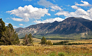
However, the byway proved not only to be paved and in great shape, but also the most scenic 46 miles of highway we have traveled over mountainous peaks and valleys in this country. It was a remarkable finale to a day of sightseeing from Mammoth Hot Springs in morning mists to the Lamar Valley, with its summertime herds of buffalo and antelope. The route from the park into the Beartooth Mountains took us through high fishing meadows around Soda Butte Creek and campground, where, later that July night, and in the early morning hours, a female grizzly bear attacked three campers and killed one of them. Fortunately, we were far afield.

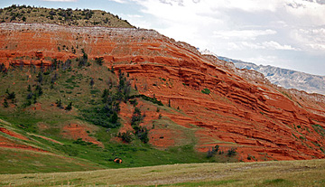
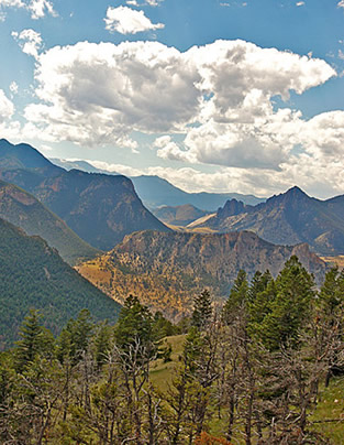
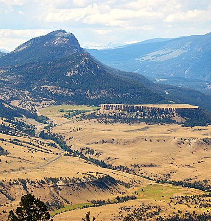
The turnoff for Chief Joseph Scenic Highway came about 14 miles east of Cooke City, and we nearly missed the little sign announcing Wyoming 296 that marked what looked like someone’s driveway. We crossed our fingers, and off we plunged, just as the road did, downwards and then twisting up, through canyons, peaks and narrow passes.

  Chief Joseph Scenic Byway  
     
Chief Joseph Scenic Byway (left middle)
 
         
  Chief Joseph Scenic Highway   Chief Joseph Scenic Highway  
 
Valley view from the Byway
 
Red ridge seen from the Byway
 
         
  The highway follows the route Chief Joseph took in 1877 to lead the Nez Perce Indians away toward Canada, as they escaped pursuing U.S. Cavalry. He and several other chiefs led 750 men, women and children over 1,170 miles through mountains in several states, as detailed on the website for the Nez Perce National Historic Trail (www.fs.fed.us/npnht). This highway is a section of the trail, and offers several stopping places with historical markers.  
     
  Click here for Google map of the Chief Joseph Scenic Byway.  
     
  Chief Joseph Scenic Byway  

For contemporary travelers in cars, this byway through the Shoshone National Forest provides vistas back toward the Absaroka Range along the east side of Yellowstone Park. Some of the most impressive views come close to its southern end, where it meets Highway 120 about 17 miles northwest of Cody.

We stopped a number of times to gaze and take photos of magnificent river valleys and gorges created by several creeks and the Clark Fork of the Yellowstone River, especially near Dead Indian Summit, elevation 8,060 feet. Though we didn’t hike down a canyon to take any photos looking upward, such a perspective appears in a photo of the bridge over Sunlight Creek, at http://en.wikipedia.org/wiki/Chief_Joseph_Scenic_Byway.

Probably the most amazing aspect of this route was how little traveled it was. We saw only five or six other cars during the entire drive, testament to the low profile this remarkable byway keeps almost secret among the wonderful tourist options in the area.


Looking toward Yellowstone


Balloon
 
     
Carolyn Dale and Tim Pilgrim
 
 
Carolyn Dale and Tim Pilgrim
 
 
at Mt. Baker
 

HOA LogoDestinationsTravel MallTravel Links